The Western Ghats of Karnataka are among the most significant biological resources of the Indian subcontinent as they are a primary watershed and a globally important biodiversity hotspot (UNESCO). This large mountainous region is composed of various montane areas, with Bisle Ghat, located in Sakleshpur Taluk, Hassan District, serving as an essential ecological link and an ideal destination for high-value, nature-based tourism. Bisle Ghat features dense Dipterocarp forests, high-altitude Shola grasslands, and a meandering, interconnected network of rivers, creating an ecologically diverse landscape that provides a significant corridor for megafauna and a tranquil retreat for environmental enthusiasts. This report contains an in-depth analysis of the Bisle Ghat area and its biogeographical significance, the complexities of its biodiversity, the logistics of accessing the area, and the changing regulatory environment that attempts to balance human activity and ecological conservation.
Overview of Bisle Ghat:
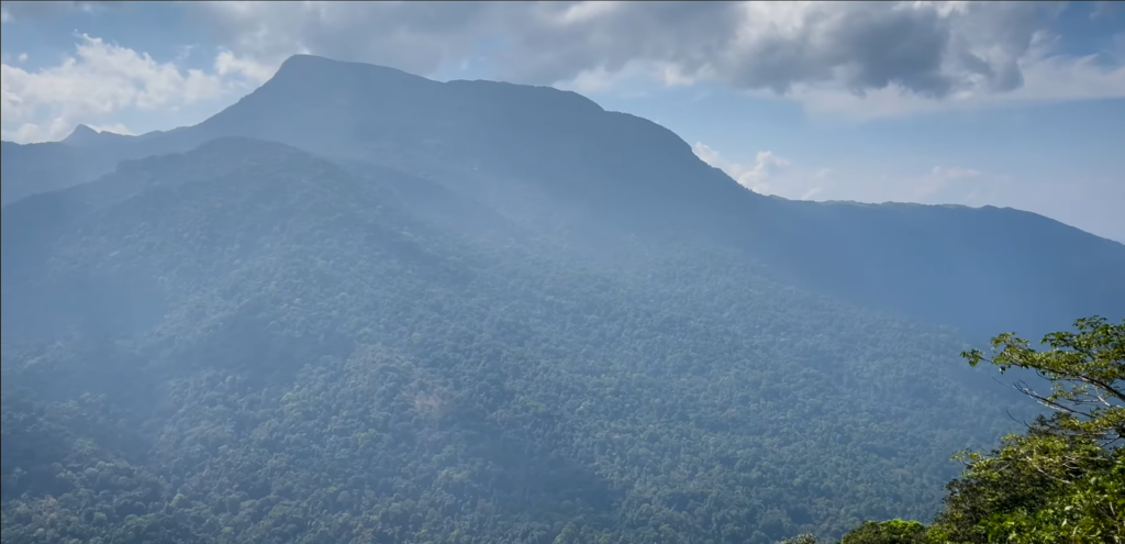
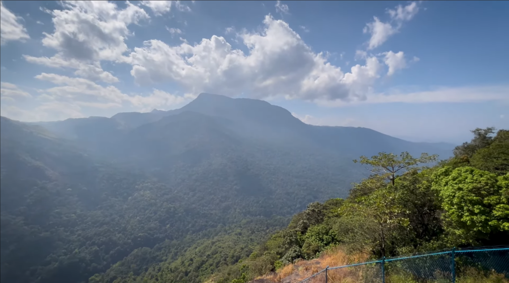
The geographical location of Bisle Ghat is defined as a convergence point of three administrative districts: the three administrative districts of Hassan, Dakshina Kannada and Kodagu. This tri-state junction provides the region with a distinctive ecological quality; it provides the link between the coastal plain and the inland plateaus. The central point of interest for most visitors to the area is the Bisle View Point, which sits at an approximate altitude of 3800 ft. above mean sea level and provides a natural amphitheatre in which to witness the meeting of the three ranges of hills; Pushpagiri, Kumara Parvatha, and Dodda Betta.
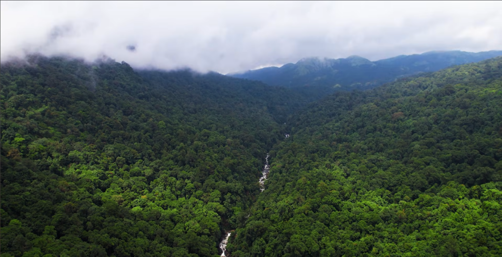
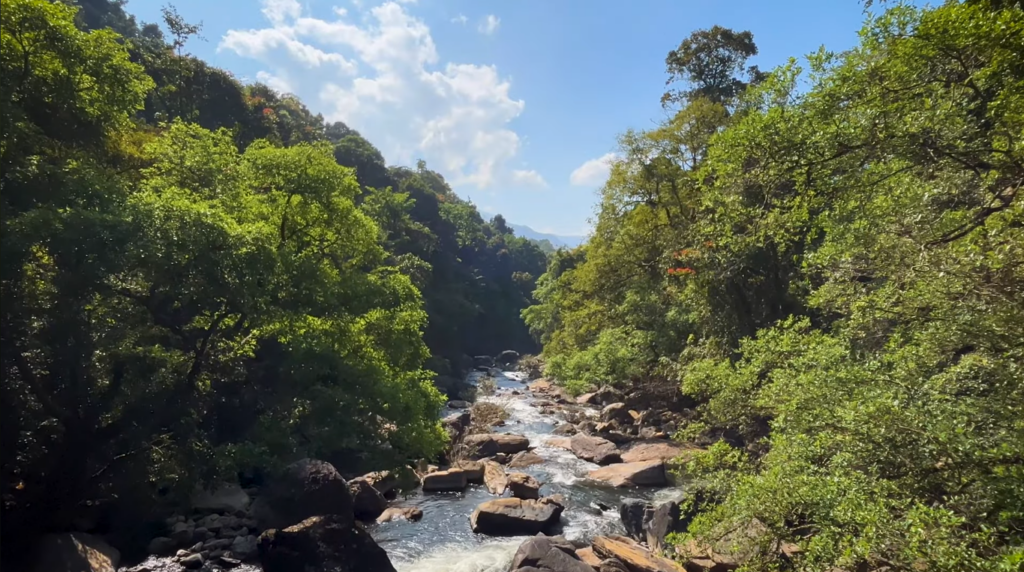
The hydrologic system of the Bisle Ghat region is dominated by the Kumaradhara River and its tributary the Giri River. These two rivers have formed extremely deep and steep-sided valleys which separate the view points along the three hills from the Western Ghats’ most significantly elevated peaks. The Kumaradhara River flows from east to west through the mountain range creating a natural pass through the range; historically, this pass served both as a means of human transportation and as a route for the migration of animals. The result of this process is an extremely steep, deep, twisty landscape with tremendous moisture-retaining capacity which is essential for supporting the evergreen forests of the region.
How to Reach Bisle Ghat:
Accessibility to the Bisle Ghat region is influenced by the mountainous terrain and the seasonal variations in weather. The primary gateway for travelers from the interior is the town of Sakleshpur, while the coastal approach is typically facilitated through Kukke Subramanya or Gundya.
| Destination | Distance from Bisle (Approx. km) | Primary Access Route | Estimated Travel Duration |
|---|---|---|---|
| Sakleshpur Town | 35–45 km | Bisle Ghat Road (via Hanbal) | 1.5–2.5 hours |
| Bangalore | 220 km | NH 75 (via Hassan) | 4–5.5 hours |
| Mangalore | 130 km | NH 75 / SH 88 (via BC Road) | 3–4 hours |
| Somwarpet | 25 km | via Shanivarsanthe | 1 hour |
| Kukke Subramanya | 20–25 km | Bisle Ghat Road (Lower Sector) | 1–1.5 hours |
The Elephant Corridor and Geopolitical Conservation
Bisle Reserve Forest plays a fundamental role as an ecological corridor, linking the Pushpagiri Wildlife Sanctuary in the south with the Kudremukh National Park in the north. This corridor is essential for the movement of the Asian Elephant, allowing for seasonal migration and genetic exchange between isolated herds. As part of the Mysore Elephant Reserve, Bisle is integrated into a larger landscape that connects the Mudumalai-Nagarhole-Brahmagiri complexes.
However, the region faces significant challenges related to human-elephant conflict (HEC). Habitat fragmentation caused by agricultural expansion and infrastructure development has led to several instances of elephants being trapped in fragmented forest islands, such as those in the Alur and Sakleshpur taluks. To address this, conservation models proposed by organizations like the Wildlife Trust of India (WTI) emphasize the “Right of Passage,” which involves the acquisition of private lands within forest areas to re-establish corridor continuity. The Karnataka state government has historically set aside funds, such as a ₹20 crore allocation in 2016, to purchase these private lands and hand them over to the Forest Department for legal protection.
Best Time to Visit
Tourism in the Bisle region is primarily focused on nature observation, photography, and trekking. The Bisle Viewpoint is the focal point of these activities, offering a panoramic outlook that has earned the region the moniker “Heaven on Earth”
| Period | Meteorological Characteristics | Implications for Tourism |
|---|---|---|
| Jan – Mar | Cool, dry weather; temperatures 15–28°C | Peak visibility for mountain ranges; ideal for trekking and photography |
| Apr – Jun | Warmer days; rainfall 50–120 mm | Lush landscapes; waterfalls begin to gain volume; morning visits recommended |
| Jul – Sep | Heavy monsoon; rainfall 200–350 mm | High mist; vibrant greenery; slippery roads; risk of leeches |
| Oct – Dec | Clear, pleasant; temperatures 14–25°C | Best time for sightings; lush post-monsoon vegetation; clear blue skies |
Monsoon (Jun-Sept): Monsoon transforms Western Ghats with lush vegetation, waterfalls are at their full flow, while misty hills give them an enchanting feel; however, caution advised due to slippery roads.
Post – Monsoon (Oct-Nov): This is the best time for visiting Bisle Ghat; the temperature is cool, sky is clear and land remains green from the monsoon rains. This is a great time for trekking or doing anything outdoors.
Winter (Dec-Feb): Winters here are pleasant and comfortable; with blue skies and cool weather making it perfect for visiting Bisle Ghat; however in the morning/evening it could be cold so warm clothes should be carried with you.
Summer (Mar-May): While summer months can be very hot, Bisley Hill has a higher altitude than the surrounding valleys, so it will be much cooler than if you were to stay at lower elevations; make sure that your trip occurs either early in the morning or late at night when it is still light outside.
Malnad Cultural Experience
Popular Local Foods of MalnadMalnad cuisine is known for its high use of rice and for how significantly various forms of foraged food from the forests are included in creating the dishes.
Examples include:1) Akki Roti, a flatbread made from rice flour and often cooked using fresh herbs and served with a spicy coconut chutney.
2) Kadubu and Shavige, steamed rice dumplings and rice noodles that come with gravies made of vegetables or meats.
3) Pandi Curry, (an example of how a dish is more traditional in Coorg but is still very much served in non-veg messes of Sakleshpur) the difference in this case is that pork based is more famous than beef based because of Kachampuli (a type of dark vinegar used when making these types of curry)
.4) Bamboo Shoot Palya, a seasonal dish that is prepared during the rainy season using finely chopped bamboo shoot.
5) Malnad Biryani, an example of how there are distinct variations of biryani that use the locally available spices and that it is often eaten in a “mess” style or in a “dhaba” style.